 WBRC staff, Paula Wood and Summer Beasley-Hoffman,
 Several Orientation and Mobility Specialists from the WBRC joined with other volunteers to assist in the creation of accessible station maps for the Bay Area Rapid Transit (BART) system stations through the LightHouse for the Blind Accessible BART Station Map project. The project supports development and publication of a set of booklets of tactile, large-print, and audio-enabled maps of BART stations to assist transit users with visual impairments in navigating the BART system. For a transit user with visual impairments, the information necessary to plan a trip extends well beyond the need for BART schedules and transfer stops. Prior knowledge of station layouts, landmarks, and important features within stations greatly enhance the efficiency and confidence with which people with visual impairments navigate through unfamiliar stations.
 BART station features such as stairs and elevators
 The maps, which will eventually be available through the Lighthouse for the Blind, will combine high contrast tactile symbols as well as ‘Smartpen’ audio technology. These tactile-audio maps, in booklet form for each station, will allow persons with visual impairments ‘explore’ the station layout at street level, concourse level, and platform level before ever stepping foot at the station. The tactile-audio maps will have representations at each of these levels which will provide information about layout including symbols noting the locations of ticket machines, stairwells, escalators, elevators, station agent booths, bus stops, taxi stands, etc. Persons that own a ‘Pulse Smartpen’ will also be able to use an application which will provide additional audio information when the pen is placed over various parts on each of these maps.

An example map with high contrast raised tactile symbols of BART station features.
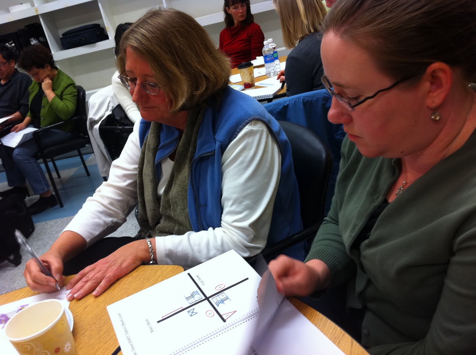
Volunteers, consisting of Orientation and Mobility Specialists, Architects, and Interior Designers, convened at the LightHouse for the Blind in San Francisco on Saturday for training. Volunteers were split into teams of two, usually consisting of an Orientation and Mobility Specialist and an Architect or Designer. Supplied with the necessary tools and station templates, each team of two traveled to 2-3 assigned BART stations to locate and record the designated elements of the street, concourse, and platform levels on the provided templates. The information collected by volunteers will be incorporated into prototype maps and given to the developer for smart pen programming prior to publication. This is the first known audio-tacile mapping project to complete an entire public transit system in the world.

